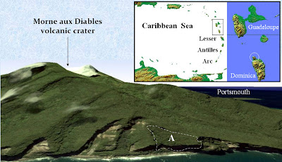
Spotting risky rock formations that are about to collapse and trigger tsunamis could be done with the help of Google Earth, new research suggests. The software could prove a useful tool where other types of survey prove too difficult or expensive.
One such spot has just been found in the Caribbean by Richard Teeuw from the Geohazard Research Centre at the University of Portsmouth, UK.
See satellite imagery of the volcano for yourself online or in Google Earth
Full article on NewScientist
One such spot has just been found in the Caribbean by Richard Teeuw from the Geohazard Research Centre at the University of Portsmouth, UK.
See satellite imagery of the volcano for yourself online or in Google Earth
Full article on NewScientist

0 comments:
Post a Comment